
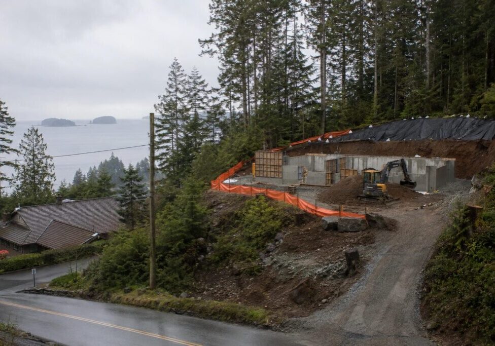
On a genuinely steep lot in the Vancouver area, the answer is almost always yes. The reason is not the one most owners expect. Whether you need a geotechnical report for a Vancouver slope is set by the municipality you are building in rather than by one region-wide rule, so the first thing to establish is not how steep the lot is but whose hazard map it sits on. It is among the first things we check with a client as their custom home builder, before anyone starts drawing.
The report itself answers a narrower question than people assume. It is not asking whether the ground will carry the house. It is asking whether the ground will stay where it is, before the build, during the build, and for the life of the house.
What a Slope Report Asks, and What Goes Into One
Two reports can both be written by a geotechnical engineer, both arrive with a seal on the cover, and answer completely different questions. Owners tend to discover that after they have paid for the wrong one.
The Question Changes on a Slope
A flat lot asks whether the ground will carry the house. A sloped lot asks whether the ground will stay where it is. Different question, different analysis, different document. A custom home soils test and a slope assessment are separate pieces of work, so having commissioned the first does not cover the second.
Coquitlam asks for a slope hazard assessment report and runs it at two levels, a preliminary one that establishes whether there is a hazard worth worrying about and a detailed one that follows if there is. Engineers and Geoscientists BC uses landslide assessment for the same professional activity. What changes between the labels is the question being asked, not a formal classification.
What Could Come Down on You, and What You Could Send Down
A slope report is not only about what the house does to the hillside. It is also about what the hillside does to the house. A lot sitting below a steep face is assessed for what could arrive from above: a debris flow down a gully, a rockfall, a slump of the bank. A lot at the crest, meaning the top edge of the slope, is assessed for what it could send down onto whoever is below. The toe is the other end, where the slope flattens out.
Most hillside lots are both problems at once, and a report that only looked uphill, or only looked downhill, has done half the job.
What Actually Happens When You Commission One
Here is the work you are buying, in order.
- The desk study. Published geology, historical air photos, terrain models, records of instability nearby, and the city’s own hazard mapping.
- The site walk. Seepage points and springs, tension cracks, old scarps, leaning trees, hummocky ground, and the condition of anything already retaining soil on your lot or the neighbour’s.
- Subsurface work. Test pits, boreholes where the analysis needs depth, and groundwater monitoring. Water pressure inside a slope is what turns stable ground into moving ground.
- The analysis. The professional measures the forces pushing the slope downhill against the forces holding it in place, under normal conditions and under an earthquake, for the slope as it stands and for the slope your build would create.
What the slope is made of drives the result. A rock face under thin soil behaves nothing like a glacial till bank, a ravine cut into layered sand and silt, or an old fill slope somebody pushed over the edge decades ago. That is why two hillside lots on the same street get different answers.
Vancouver Slope Lots: The Two Stages Where a Geotechnical Report Requirement Lands

Two different doors lead to the same place. Which one you walk through depends on the municipality, and it decides when in your project the requirement lands on you.
The Building Permit Route: The Official Can Ask, and Ask Is Enough
Across the Lower Mainland, the Community Charter gives a building inspector a direct power. Where the inspector considers that construction would be on land subject, or likely subject, to land slip, rockfall, erosion or subsidence, among the hazards the law names, the inspector can require the owner to provide a report from a qualified professional certifying the land may be used safely for the use intended.
The trigger is the part owners misread. Nothing there turns on a slope percentage. It turns on the official’s judgment that the land is or may be subject to a named hazard, and the percentages come later, and locally. The City of Vancouver runs its own building by-law under its own charter, so there the requirement reaches you through the city’s own geotechnical and shoring rules.
The Development Permit Route: When the Hazard Is Already on a Map
Some municipalities do not wait for a building permit. Under the Local Government Act, a community’s official plan can designate development permit areas to protect development from hazardous conditions, and inside one of those areas the development permit comes first.
Inside a hazard area the restriction is not only on putting up a building. The land itself must not be altered, which pulls in grading, fill, excavation and clearing before any house exists. People start with a bit of site tidying and learn afterwards that the tidying was the regulated act.
What Counts as Construction, and What Does Not
If you are renovating rather than building new, the scope is narrower than you might fear. The provincial power reaches new construction of a building or structure, and the structural alteration of or addition to an existing one, and it expressly leaves out repair. Replacing a rotten deck ledger is not the same act as pushing the back of the house out over the slope.
Inside a mapped hazard area, altering the land is caught on its own, so a project that is not building anything can still need a permit. Neither half of that answer works on its own.
What the Report Can Say, and What Each Answer Means

Owners read this process as pass or fail, and brace for the fail. It does not work that way. There are three outcomes available, and only one of them stops the project.
Yes, With Conditions: What the Conditions Actually Cover
Where the qualified professional certifies that the land may be used safely if it is used in accordance with the conditions set out in their report, the permit can be issued on that basis. In practice, on a hillside lot in this region, yes with conditions is the usual answer, and owners read it as a no far more often than they should.
Conditions is a broad word. It covers setbacks from the crest and the toe, limits on cut and fill, the foundation type, retaining and shoring, a drainage design, erosion and sediment control, limits on vegetation removal, and a construction sequence.
How heavy those conditions get depends on who is downhill. Risk is measured against consequence, so a slope above a lane, a road or somebody’s house is a materially different problem from a slope above your own back garden, and it changes how conservative the recommendations are.
No, Which Is the One Answer That Stops a Permit Cold
If the qualified professional determines that the land may not be used safely for the use intended, the building inspector must not issue a building permit. Not may refuse. Must not issue. There is no discretion in that, and nothing to argue at the counter.
For anyone still holding a subject-to clause, that is the whole case for sequencing this properly. An opinion obtained while your offer is still conditional costs you an assessment. The same opinion after the offer goes firm can leave you owning a lot you cannot build your house on. The time to find out is before, not after.
When Council Can Direct the Official to Issue the Permit
There is a third outcome, and almost nobody knows about it. Where an inspector is authorized to issue a permit on that conditional basis but refuses to, council can, on the owner’s application, direct the inspector to issue it, subject to the same covenant requirements that would have applied anyway.
That matters for two reasons. It tells you a refusal is not automatically the end of the road, and it tells you where the route runs: through an application to council, not through a longer argument with the person who said no.
The Covenant That Can End Up on Your Title
This follows the conditional permit route, not every slope report. Where a permit is issued because a professional said yes with conditions, something gets registered against the property. It is the outcome that outlives the build, and it is much better understood calmly in advance than discovered at closing.
What Gets Registered, and What It Binds You To
A covenant is a promise about the land written into the title record, so it travels with the property rather than the person. When a permit is issued on the strength of a conditional report, the owner covenants with the municipality to use the land only in the way the professional certified as safe, and that covenant goes on title under the Land Title Act.
A covenant of this kind can be positive or negative. The positive half is the one that surprises people, because it can oblige you to do things, such as maintain the drainage works the report called for. It can also provide that the land is not to be built on except in accordance with the covenant, or not at all.
It Follows the Property, Not Just You
A covenant of this kind is enforceable against later owners even though the municipality holds no adjoining land. That is the entire point of registering it against title rather than signing an agreement with you personally.
So it survives the sale. Whoever buys the house inherits the conditions your report set, and their lawyer will find it on the title search. Does this follow me, and does it follow the next owner? Yes, and yes.
The Reimbursement Clause Almost Nobody Expects
The covenant must contain conditions about the owner reimbursing the municipality for expenses it incurs as a result of a breach. That clause is there by law rather than local preference, and owners have rarely heard of it before they sign.
None of this is alarming on a well-run build, where the conditions are designed into the drawings and confirmed on site as the work goes in. Your lawyer reads your title, and a hillside lot is exactly the sort of purchase to ask them about before you remove your conditions.
How Municipalities Around Vancouver Handle It

Each municipality sets its own trigger, and they are not the same. Some publish a gradient, some map the hazard areas and let the map decide, and some leave it to the building official. The eight below are where the region’s steep residential ground sits: the North Shore, the Coquitlam escarpments and Burke Mountain, Burnaby’s hillsides, the Port Moody slopes, the West Vancouver hillside, and the Maple Ridge and Surrey bluffs. The instrument matters more than the gradient, because the instrument decides when in your project the requirement lands.
| Municipality | Which stage the requirement lands at | What they ask you for |
| District of North Vancouver | Slope Hazard Development Permit Area, mapped publicly | A slope hazard assessment by a professional engineer or geoscientist with geohazard experience |
| District of West Vancouver | Development permit, and potentially again at building permit | A geotechnical assessment of site stability and of whether the site is feasible to develop |
| City of Coquitlam | Zoning bylaw slope zone | A slope hazard assessment report by a qualified professional, preliminary or detailed, written against the city’s published criteria |
| City of Port Moody | Development Permit Area 5, protection of development from hazardous conditions | A geotechnical engineer’s report identifying the hazards and setting out how the development can be safely built and maintained |
| City of Burnaby | Building permit | A signed and sealed geotechnical letter of assurance with the submission for a new single family dwelling |
| City of Surrey | Hazard Lands development permit, before land alteration or clearing as well as before building | Qualified professional information and a stormwater management plan |
| City of Maple Ridge | Natural Features development permit | Geotechnical comment on and oversight of the proposed work, depending on its location and scope |
| City of Vancouver | Building permit, under the city’s own building by-law | Geotechnical and shoring design for one and two family homes |
North Vancouver and West Vancouver: Mapped Hazard Areas and a Second Report at Building Permit
The District of North Vancouver’s slope hazard areas are mapped, and the mapping is public. You can find out which side of the line a lot sits on before you make an offer, rather than after the designer has drawn something.
West Vancouver is the reminder that one assessment does not always finish the job. An assessment of site stability at the development permit stage can be followed by a further report specific to each new dwelling, required at building permit by the Chief Building Official. Two reports, two stages, and it catches owners who thought that work was behind them.
Coquitlam and Port Moody: A Slope Zone and a Hazard Permit Area
If you are building on genuinely steep ground in this region, there is a fair chance it is in Coquitlam. The chines and ravines above the river, the Corona escarpment, Westwood Plateau and Burke Mountain hold much of the region’s buildable hillside inventory. Its guidance for living near steep slopes is worth reading before you buy rather than after.
The city’s own site development guidance tells applicants to get geotechnical input in the preliminary stages, to understand the soil condition and the effect of surface drainage flows. That is the get it early instruction arriving from the city rather than from a builder.
Port Moody puts it plainly. Its development permit process asks a geotechnical engineer to identify the relevant hazards and set out how the development can be safely constructed and maintained.
And maintained is the phrase to hold on to. The report does not stop at the day the house is finished, and neither does the owner’s obligation.
Burnaby and Vancouver: Letters of Assurance and Shoring Design at Permit Stage
Burnaby’s official community plan designates development permit areas for form and character, streamside protection and tenant protection, and the form and character area applies to multi-family, commercial and industrial development. On a Burnaby hillside the geotechnical requirement therefore arrives with the building permit, and the city’s submission checklist for a new single family dwelling asks for a signed and sealed geotechnical letter of assurance.
The City of Vancouver builds under its own by-law and publishes its geotechnical and shoring requirements for one and two family homes. On a Vancouver lot it reaches the owner through excavation, shoring and geotechnical design at building permit stage.
Surrey and Maple Ridge: When the Neighbour’s Slope Catches Your Lot
In Surrey the buffers are the surprise. A parcel can be pulled into the hazard lands designation because of what is above it or below it, rather than because it is steep itself, which is how a flat lot at the bottom of a bank ends up in the same process as the property above. The clearing trigger reaches further than people expect as well, since it catches removing trees or shrubs.
Maple Ridge draws the hardest line of the group. Above a stated gradient the slope may not be altered at all, so part of the ground is closed to regrading as well as to building, whatever the owner had planned for it.
Who Is Allowed to Write the Report

Not every engineer, and not only engineers. This is a regulated role with a defined qualification behind it, which is worth knowing before you start phoning around. There is also one document to collect before you engage anyone.
What “Qualified Professional” Means Here
The province defines the qualified professional as a professional engineer, or a professional geoscientist with experience or training in geotechnical study and geohazard assessments. That second half is the part owners do not expect. Geoscientists are admitted alongside engineers, because reading what a hillside is made of and what it has done before is geology as much as engineering.
Engineers and Geoscientists BC publishes practice guidance for landslide assessments in British Columbia, including an assurance statement the professional signs, and that signed statement is often the artifact a municipality wants in the file.
Ask Your City for Its Checklist Before You Hire Anyone
Before you hire anyone, check with your municipality for the checklist or terms of reference that sets out what a slope report has to answer. Coquitlam and Port Moody both publish one, and they are specific.
Then hand that checklist to the professional you engage, at the start and not after you have seen a first draft. A report written against the city’s own headings is the one that gets accepted the first time. It also stops you paying for a general opinion that does not answer the questions the reviewer has to ask.
When an Existing Report Stops Being Usable on a Hillside
Two things make an existing report stop working on a slope.
The first is distance. On a hillside, ground conditions change over metres rather than over the long, gradual shifts of flat ground. The lot next door can sit on different material, above a different seepage line, at a different point on the same slope.
The second is time and design. An old report on your own lot fails the moment the design changes, because its conditions were written against a particular envelope and a particular cut. Move the house uphill, deepen the excavation or add a level, and the report is describing a project that no longer exists.
What It Changes About the House and the Lot
This is where the report stops being paperwork and starts drawing lines on your site plan. The design consequences come first, and they arrive before you have a floor plan worth defending. The construction consequences follow.
Where the House Can Sit, and How Much of the Lot You Actually Get
Start with the envelope, because a commercial fact is hiding inside a technical process. A development permit for land in a hazard area can specify areas that must remain free of development. Put that beside a rule like Maple Ridge’s, where above a stated gradient the slope may not be altered at all, and the conclusion follows: on a hillside, the buildable area rather than the lot area is what you are buying. Two lots of the same size on the same street can offer very different amounts of house.
Then siting, which is the same question from the other end. On a slope, siting is not an aesthetic decision. The setback from the crest, meaning how far back you must stay from the top edge, the setback from the toe at the bottom, and whatever is left in between all interact, and they interact with where vehicle access can physically land.
This is the constraint most likely to send a floor plan back to the designer, and the strongest argument there is for running the report ahead of the design.
Access and the Driveway: The Constraint That Moves the House
Access is a hard constraint on a steep lot, not a detail to resolve later. There is a limit to how steeply a driveway may rise before your city will not accept it, and the consequence is the part worth writing down: the access grade decides where the garage can land, and the garage decides where the house can land. That is why access gets settled with the siting rather than drawn in at the end.
On a tight hillside lot, a driveway that will not work is a floor plan that will not work. We would rather establish that from a topographic survey than from drawings you have already paid for.
What It Changes About the Ground Work

The report is a small line on a budget. Its recommendations are not, and they show up on the schedule as well. Three mechanisms do most of the work on a slope: where the water goes, what you add to or take off the hillside, and how you hold the ground open while you build.
Drainage Is Usually the Real Story
Water pressure inside a slope is the variable that turns stable ground into moving ground.
Coquitlam tells residents to divert water away from the slope, including roof drainage, and where water would otherwise drain to the ravine or the slope, to pipe it to the bottom of the slope so it does not saturate the slope on the way down. That is the whole argument in one instruction. What the report does about drainage and subdrains is often more consequential than what it does about the footings, and far cheaper to design in than to retrofit.
Clearing, Fill and Retaining All Change the Balance
All three are changes to the load on the slope.
Adding fill at the top of a slope or near a drainage channel, including a retaining wall built to raise the level of your property, puts weight where the slope can least carry it. Maintaining the slope’s vegetation strengthens its stability, so on a hillside clearing is a stability question and not only a tree bylaw question. That gets more complicated on a lot with a house already on it, where clearing and demolition arrive together.
A retaining wall on a slope is structure, not landscaping. Past a certain height, and any time it is holding back a driveway, a building or a neighbour’s ground, it needs an engineered design and its own approval. So put every wall on the plan in front of the professional writing the slope recommendations, and let them tell you which ones are structure.
Excavation, Shoring and the House Next Door
Shoring is the temporary structure that holds an open excavation face in place while you work in front of it. On a hillside it is where the disputes live.
Under the BC Building Code, where the stability of an adjoining building or of adjacent municipal infrastructure could be endangered by excavation work, adequate underpinning, shoring and bracing has to be provided to prevent damage to or movement of the adjoining building. That is not a courtesy to the neighbour. It is a requirement, and it belongs to a professional rather than the excavator’s judgment on the day.
The City of Vancouver builds under its own by-law, and publishes its own geotechnical and shoring requirements for one and two family homes.
What Drives the Cost, and When to Get It Done

Two questions arrive together on every hillside lot: what will this cost, and when should I do it. The answers are causal rather than numerical, because the number depends on decisions nobody has made yet. What drives the number is knowable from the start.
The Money Is in the Retaining, the Shoring and the Drainage
A slope assessment is priced to the lot, and it comes in stages. A first-pass assessment that tells you whether there is a hazard worth worrying about is a modest number against a custom home budget. A full assessment with boreholes, groundwater monitoring and stability analysis is several times that.
Either way, the assessment is the small figure and what it recommends is the large one. The retaining, the shoring, the engineered drainage and the stepped foundation are where the budget actually moves, and they are why the same house on a flat lot and on a sloped lot is two different projects. If you are working out where the money actually goes on a Lower Mainland build, slope work is one of the larger swing factors on the list.
Where the Report Sits in Your Schedule, and Why the Order Decides the Price
The same report costs about the same whenever you commission it, and is worth wildly different amounts depending on when that is. Ordered before the design, it shapes the design. Ordered after, it audits it, and an audit that comes back with a crest setback nobody planned for means paying for the drawings twice. Coquitlam’s own guidance points the same way, telling applicants to get geotechnical input in the preliminary stages.
A slope assessment adds a stage to the front of the project, and on a hillside lot it usually sets the start date, because the design cannot be finished until the report says where the house may sit. Build it into the schedule at the point you secure the lot, not at the point you apply for the permit.
A detailed build schedule with pre-booked trades depends on that front-end stage holding. Trades are booked against dates, and a stage that moves at the front moves every date behind it.
Why the Report Does Not End at Permit Issue
The obligation ends at the title of the property, and it runs through the whole build to get there. Owners treat the report as a hurdle that closes at permit issue, then find the professional who signed it still involved and still accountable.
The Two Forms Your Engineer Signs, and When
You will see two documents in your own permit set. Schedule B is where the professional assures the design and commits to field review during construction. Schedule C-B is what they provide once construction is complete, all field reviews are done and the work substantially complies. These are the letters of assurance, and the commitment made at permit stage is discharged only at the end, and only by the same professional who made it.
There is also a check you can run yourself. A firm’s permit to practice number has to appear on authenticated documents, and documents lacking it do not meet the requirement. An owner can look for that without knowing anything about geotechnical engineering.
Two Geotechnical Roles: Temporary and Permanent
The letters of assurance system splits geotechnical responsibility in two. The temporary condition covers the excavation and the shoring while the hole is open. The permanent condition covers the finished result: the slope as it is left, the retaining, and the foundation.
The split exists because those are two different risks with two different lifespans. One lasts a few months and is at its most dangerous the day it is deepest. The other lasts as long as the house. On a slope both are live at once, which is why one lot can carry two geotechnical commitments side by side.
The Field Reviews That Actually Matter
Conditions are worthless if nobody confirms they were followed. On a slope, the reviews get scheduled around the moments that cannot be inspected later: the open excavation, the shoring, the subdrains before they are buried, and the retaining walls before backfill. Once backfill goes in, the only way to check a subdrain is to dig it up again.
The practical consequence is a scheduling one. Those are hold points, and a builder who has not booked them has a crew standing and waiting for a professional to become available. We book them into the sequence rather than phoning when the hole is already open.
Building on a Slope Is a Sequencing Problem Before It Is a Structural One
Everything above is one argument. The order you do things in on a hillside lot decides what the build costs: the report before the design, the access grade before the floor plan, the drainage before the excavation, and the field reviews booked before the sequence depends on them.
That order is what we build our schedules around at Bali Brothers Construction. Fixed-price contracts matter more on a slope than anywhere else, because the report’s recommendations are where the surprises usually live, and a detailed schedule with pre-booked trades absorbs geotechnical hold points instead of watching the sequence slip. Clients also see progress photos through the portal, which matters when the work is below grade and about to disappear under backfill.
Sloped lots are a regular part of our luxury custom homes work across the Lower Mainland.
If you are looking at a hillside lot, or you already own one, get in touch with the address and we will give you a straight read on what it will take.
Frequently Asked Questions
Do I Need a Geotechnical Report to Build on a Slope Near Vancouver?
Usually yes on a genuinely steep lot. Which instrument gets you there depends on the municipality: some map their hazard areas and require a development permit before you build or even alter the land, some leave it to the building official at building permit stage, and some do both. Across the Lower Mainland, a building inspector who considers that a lot is subject to land slip, rockfall, erosion or subsidence can require a report confirming the land may be used safely.
Who Is Allowed to Write a Slope Report in British Columbia?
A professional engineer, or a professional geoscientist with experience or training in geotechnical study and geohazard assessments. Both are named in provincial law, which surprises owners who assume the work is engineering only. What matters as much as the designation is relevant slope experience, so ask what hillside work the individual has actually done.
Can a City Refuse My Building Permit Because of a Slope?
Yes. Where the qualified professional determines the land may not be used safely for the intended use, the building inspector must not issue the permit. There is a route past it, though. Where an inspector could have issued a permit on a conditional basis but refused, council can direct the inspector to issue it on the owner’s application, subject to the covenant requirements.
Will a Slope Report Put a Covenant on My Title?
If the permit is issued on the strength of a report saying the land can be used safely subject to conditions, then yes. The owner covenants with the municipality to use the land only in the way that was certified as safe, the covenant is registered against the title, and it binds later owners too. Your lawyer is the person to read your own title.
Does a Renovation or an Addition on a Slope Trigger a Report?
It can. The provincial power covers new construction and the structural alteration of or addition to an existing building, and it expressly leaves out repair. But inside a mapped hazard area, altering the land is caught on its own, so regrading, filling or clearing can require a permit even when nothing is being built. A deck footing at the crest of a slope is a bigger event than it looks.
Can the City Make Me Leave Part of My Lot Undeveloped?
Yes. For land in a designated hazard area, a development permit can specify areas that must remain free of development. That is why the buildable area and the lot area are different things on a hillside, and why the lot size on the listing is not the size you get to use. Establish it before you make an offer, not after the designer starts work.
How Do I Find Out Whether My Lot Is in a Hazard Area Before I Buy It?
Check with your municipality. Some map their hazard areas publicly and you can look the address up yourself, and the District of North Vancouver’s slope hazard mapping is one of those. Others answer at the counter, and the development or building department will tell you which side of the line the lot sits on. Either way it takes a phone call rather than a consultant, and it is worth doing before the offer goes firm.